
Walking Ute Country
A day in Colorado’s high country thinking about trail signs, Tribal history, public lands, and what it means to tell better stories in the mountains.

You’d think that working for the Forest Service, you’d spend a lot of time outside. And for some of our teams, that’s absolutely true. But for my position as Tribal Liaison, I tend to spend more and more time in the office, reading policy, advising decision makers, and working the phone and internet lines to keep communication flowing.1
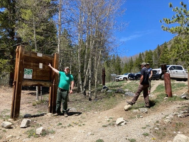
Thursday offered the rare opportunity to get back out into the woods with my colleagues to work on a project several years in the making. Our mission that day was to get out and inspect some of the extant trail signs at some of the Colorado 14ers (the 58 mountains over 14,000 feet tall). These trails are important because due to their size, these mountains attract a lot of attention from hikers, tourists, and people from Texas.2 That means good signs are important to advise people about where they are, what precautions to take (always pack water and layers in Colorado), what not to do (please, please, please don’t start fires where they are not allowed), and what animals visitors might see, like black bears, elk, bighorn sheep, and mountain lions.3
For me, this is an opportunity to help educate people on Colorado’s Indigenous heritage and continuity. As a historian, one of the things particularly important to me is telling better stories here in our forests. That doesn’t mean not telling the histories of settlers and other folks—they’re important too—I just want to make sure that the Tribes I know and love are being represented out here.
This can be tricky. There’s the whole thing about what stories do we tell? Whose stories do we tell? Who is telling them? Where do the signs go?
There’s some debate among academics about telling Native stories. And from my experience, there’s a whole cadre of professors out there willing to self-flagellate by calling themselves “settler scholars” in hopes of performing for some audience out there. That was in my mind for a long time too, until I had enough elders tell me not to worry about that stuff and just speak from the heart about what I knew to be true. Besides, I’m not an academic anymore. I’m just a guy with a Ph.D. and a hunting license.
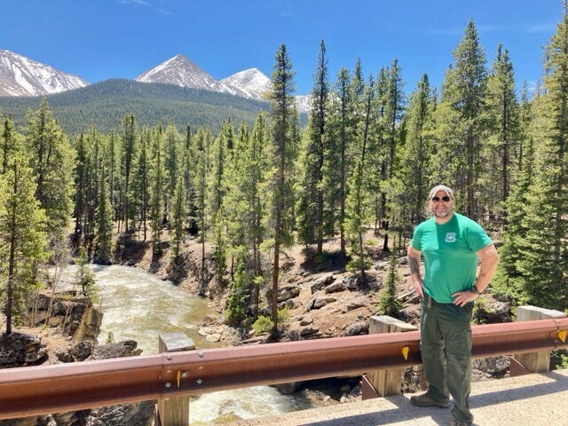
We spent Thursday out near the town of Leadville, the highest city in the country—no not that kind. I mean elevation. Leadville stands at 10,154’ up in the air, meaning that the mountain trails were also way high up. For me, I have to physically see a space in order to understand it. It’s one thing to look at an image online or sit in on a virtual meeting, but I need to be physically present in order to conceptualize it.
If you haven’t been to this part of Colorado before, well, you should come out here and see it for yourself. It’s a mix of mountains, high plains, forests, streams, and marshlands. And every time I’m here I’m kind of blown away by it.4 In fact, I usually have to add time to my drive because I know I’m going to stop somewhere and take pictures. This was the case as I emerged from the Wilkerson Pass summit to see this landscape laid out before me:
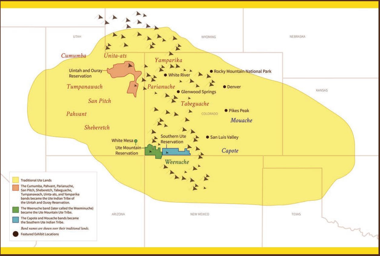
Proceeding on with my colleagues in Leadville, we visited three sites to talk about what kinds of signs would best work there and what kind of information should be present. Colorado is home to a number of Tribes, which requires a balancing act of how I do my work. I never ever want to show favoritism or anything like that, and I am hyper aware of ensuring that every Tribe is included where they should be. Fortunately for me, Thursday’s destination was pretty solidly in Ute Country (though other peoples have a presence there too), so I was thinking about the conversations I’d had with Tribal Members about what they wanted me to say about them and their history. The big thing that continues to come up is reinforcing that Tribal Members are still here, and that they welcome outsiders to visit and commune respectfully with their homelands. So when I think about what to write, it’s with this in mind. And by the way, if you don’t know, traditional Ute lands are HUGE. Take a look at this map from the Golden History Museum:
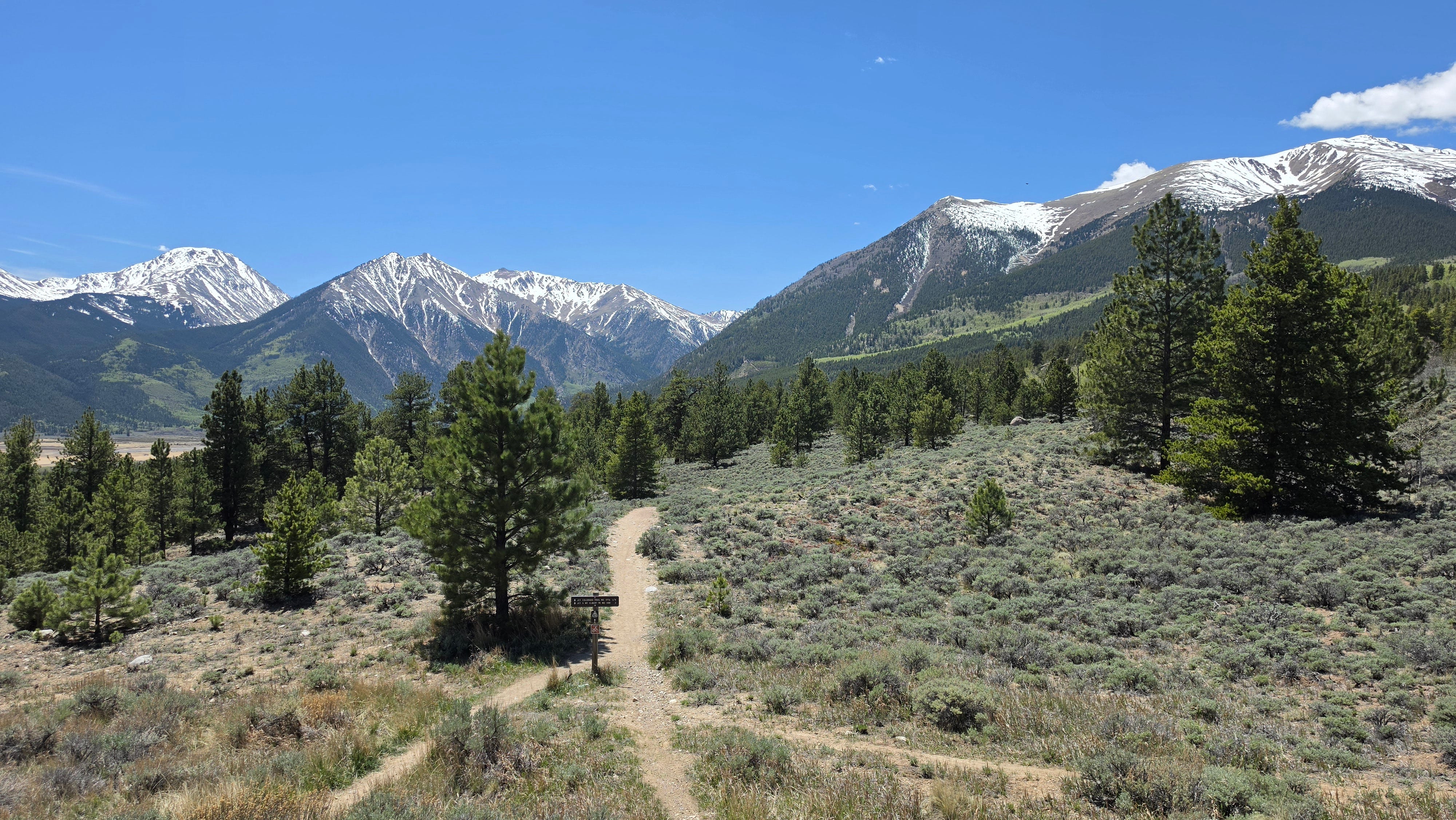
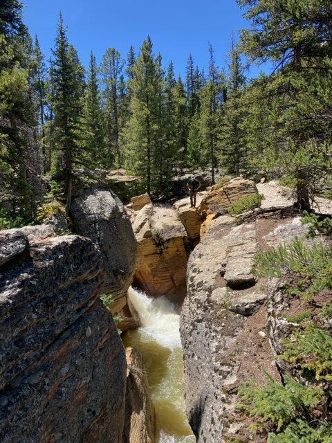
They’re also pretty damn beautiful, as witnessed in a few of these photos we took in the field:
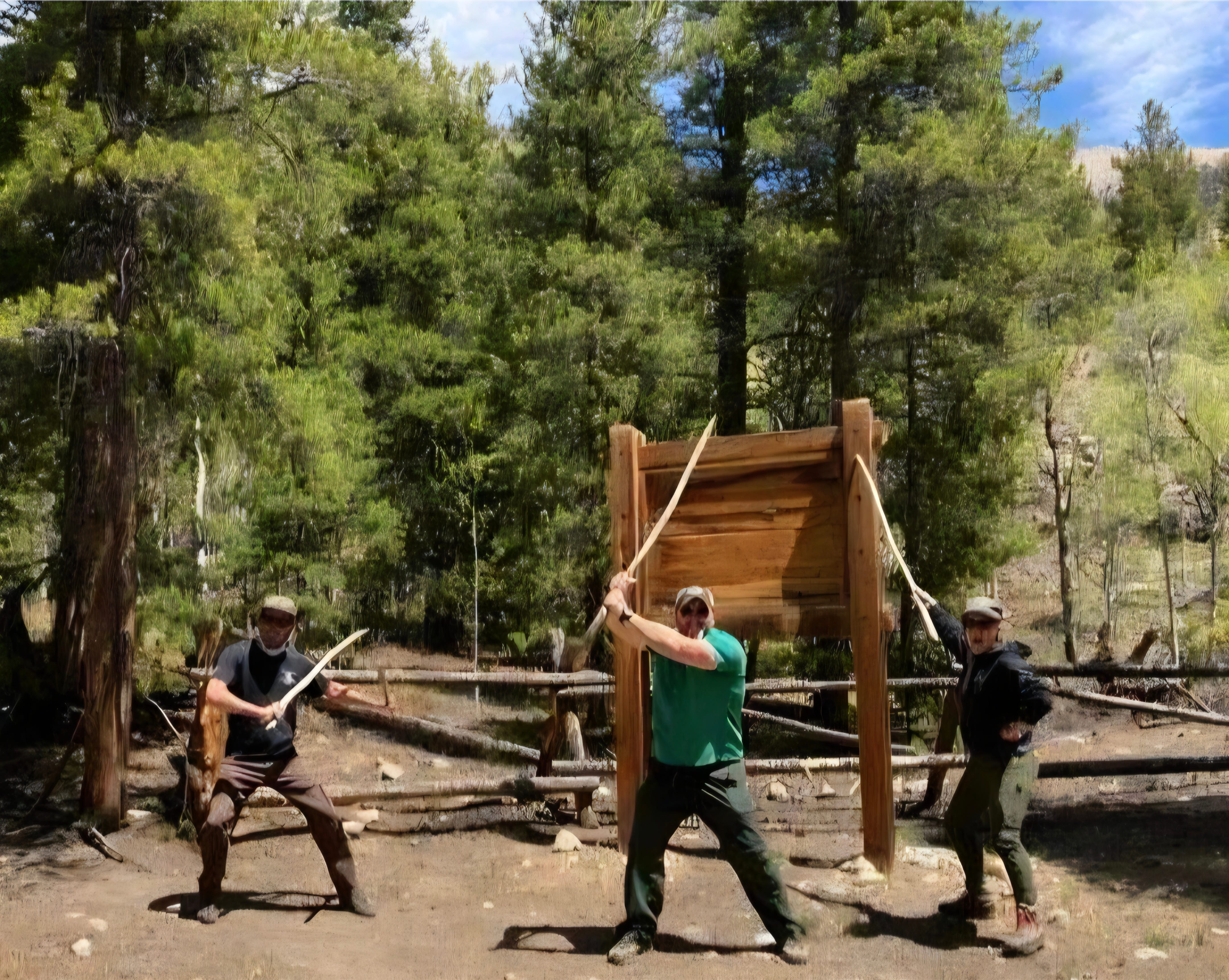
And along the way, the four of us talked about why we worked for the Forest Service. The common bond was that we liked the idea of giving back to our society and that there was a sense of pride when we wore that shield on our chests. Working here means belonging to something we feel is important.
And then we also found sticks, meaning that for a moment, we could imagine we were not just Forest Service employees, but also Jedi. I sent these images on to my boss in unending attempt to make him question exactly what the heck it is I do with my free time.
So there you go. A short (and not Forest Service endorsed) visit to see your public lands in public hands. Every day is a good day to learn a little more about Native history out here.
Jason
Hey thanks for reading this and thanks for being here. If you like these takes on history, pop culture, and public lands, become a paid subscriber. Buttons below.
Standard procedure here folks: this substack is not endorsed by the federal government, the US Forest Service, or Smokey Bear.
Texas is to Colorado what New Jersey is to Florida.
They call the latter “cats” here for shorthand. I don’t know why, but I like this.
It could also be the lack of oxygen.
I have volunteered with the forest service here in North Carolina and they are just wonderful people. I also like your photos because they remind me of my two trips to the Leadville area (among 4 others to Colorado. A thoughtful and illuminating piece.